


0551484 - LYERLY Voting District, Chattooga County, Georgia
About
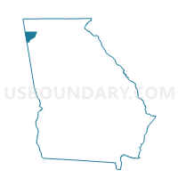
Outline

Summary
| Unique Area Identifier | 560609 |
| Name | 0551484 - LYERLY Voting District |
| County | Chattooga County |
| State | Georgia |
| Area (square miles) | 23.57 |
| Land Area (square miles) | 23.57 |
| Water Area (square miles) | 0.00 |
| % of Land Area | 100.00 |
| % of Water Area | 0.00 |
| Latitude of the Internal Point | 34.39958740 |
| Longtitude of the Internal Point | -85.41254230 |
Maps


Graphs
Select a template below for downloading or customizing gragh for 0551484 - LYERLY Voting District, Chattooga County, Georgia


Neighbors
Neighoring Voting District (by Name) Neighboring Voting District on the Map
- 0551083 - COLDWATER Voting District, Chattooga County, GA
- 0551216 - DIRTSELLER Voting District, Chattooga County, GA
- 055925 - SUMMERVILLE Voting District, Chattooga County, GA
- 055940 - DIRTTOWN Voting District, Chattooga County, GA
- 055961 - SEMINOLE Voting District, Chattooga County, GA
- Broomtown Volunteer Fire Dept., Cherokee County, AL
- Friendship Baptist Church/Mt. Calvery Baptist Church, Cherokee County, AL
- Gaylesville Town Hall, Cherokee County, AL
Top 10 Neighboring County Subdivision (by Population) Neighboring County Subdivision on the Map
- Summerville CCD, Chattooga County, GA (11,699)
- Cedar Bluff-Gaylesville CCD, Cherokee County, AL (7,204)
- Menlo CCD, Chattooga County, GA (2,891)
- Lyerly CCD, Chattooga County, GA (2,723)
- Little Sand Mountain CCD, Chattooga County, GA (2,255)
Top 10 Neighboring Place (by Population) Neighboring Place on the Map
Top 10 Neighboring Unified School District (by Population) Neighboring Unified School District on the Map
Top 10 Neighboring State Legislative District Lower Chamber (by Population) Neighboring State Legislative District Lower Chamber on the Map
Top 10 Neighboring State Legislative District Upper Chamber (by Population) Neighboring State Legislative District Upper Chamber on the Map
Top 10 Neighboring 111th Congressional District (by Population) Neighboring 111th Congressional District on the Map
Top 10 Neighboring Census Tract (by Population) Neighboring Census Tract on the Map
- Census Tract 105, Chattooga County, GA (6,424)
- Census Tract 9557.02, Cherokee County, AL (3,872)
- Census Tract 103, Chattooga County, GA (2,891)
- Census Tract 106, Chattooga County, GA (2,723)
- Census Tract 101, Chattooga County, GA (2,255)